Hummingbird Springs (AZ)
Mojave-Sonora Gold Belt
Property Details
| Location | Arizona, USA |
|---|---|
| Address | 0 N Wickenburg Rd A, Tonopah, Az 85354 |
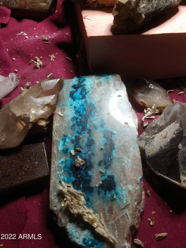
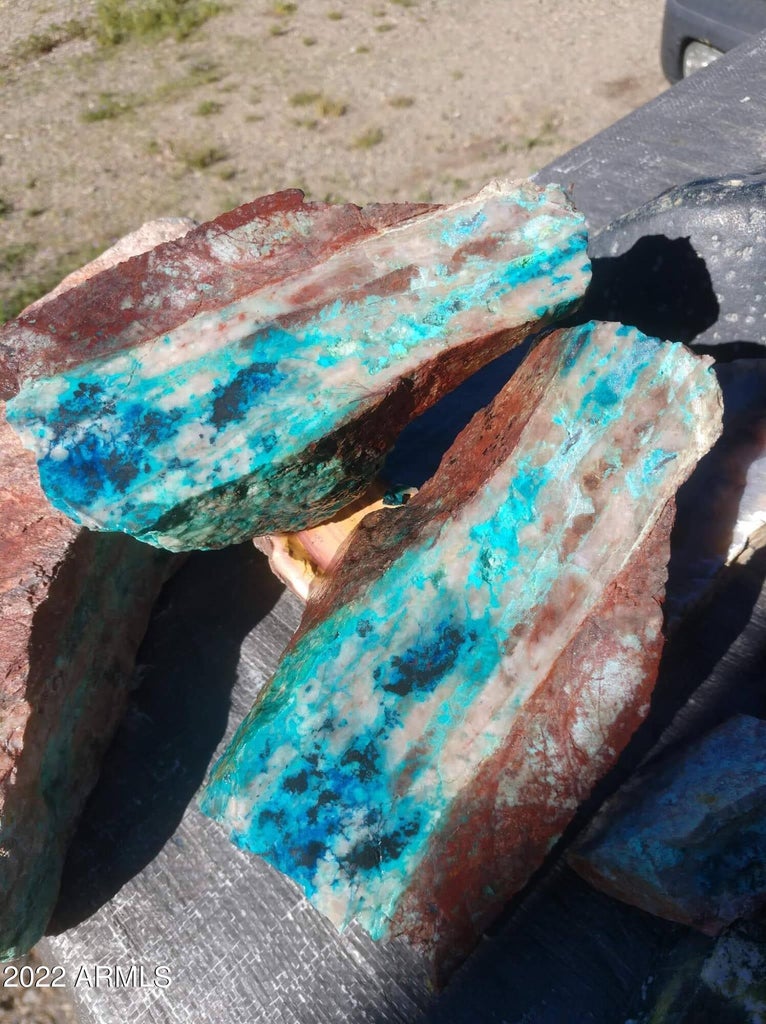
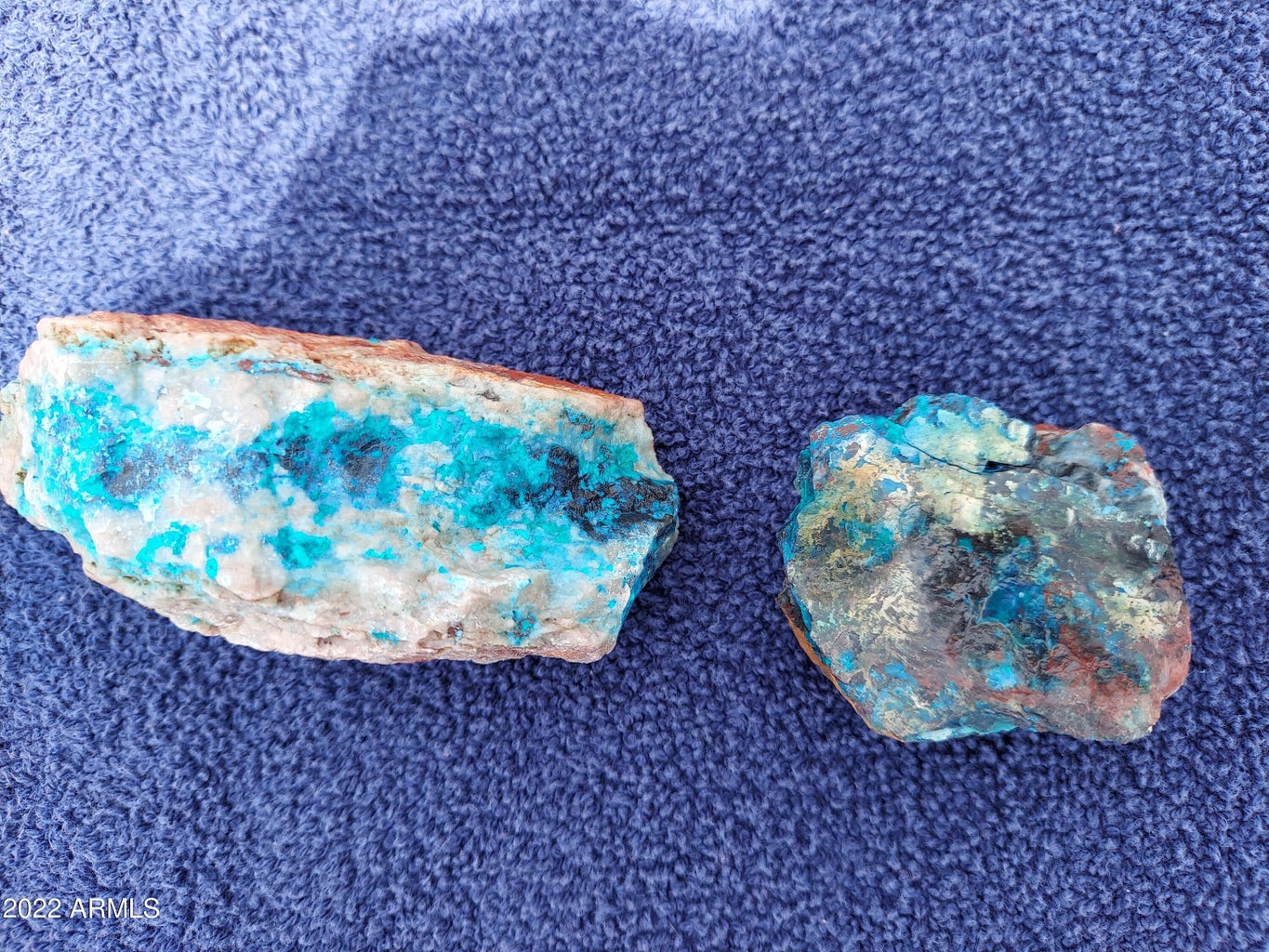
| Commodities | Clay, Copper, Dolomite, Gold, Granite, Iron Oxide, Limestone, Quartz, Quartzite, Silver |
| Deposit Type | Hard rock |
| Mining Phase | Inactive |
| Asking Price | 6,800,000.00 |
| Available Terms | For Sale, Lease Purchase Option, Negotiable |
| Listing Tier | Featured |
| Market Status | Listed |
Summary
Location and Access
South of Hummingbird Springs Wilderness area
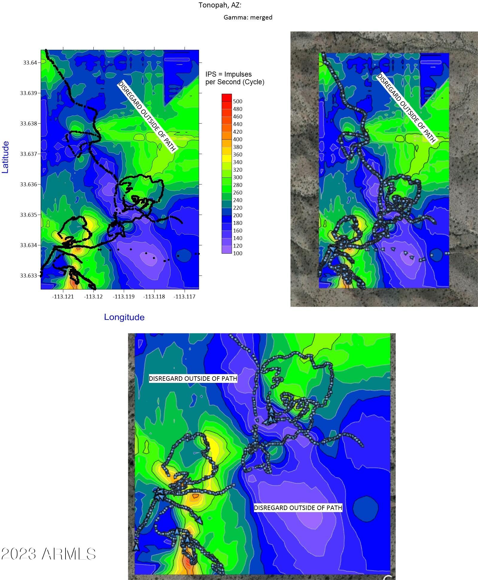
Latitude
33.634921333467
Longitude
-113.119108268868
Between Hummingbird Springs and Big Horn Mountains Wilderness - access from Eagle Eyete Rd - east to property
Description
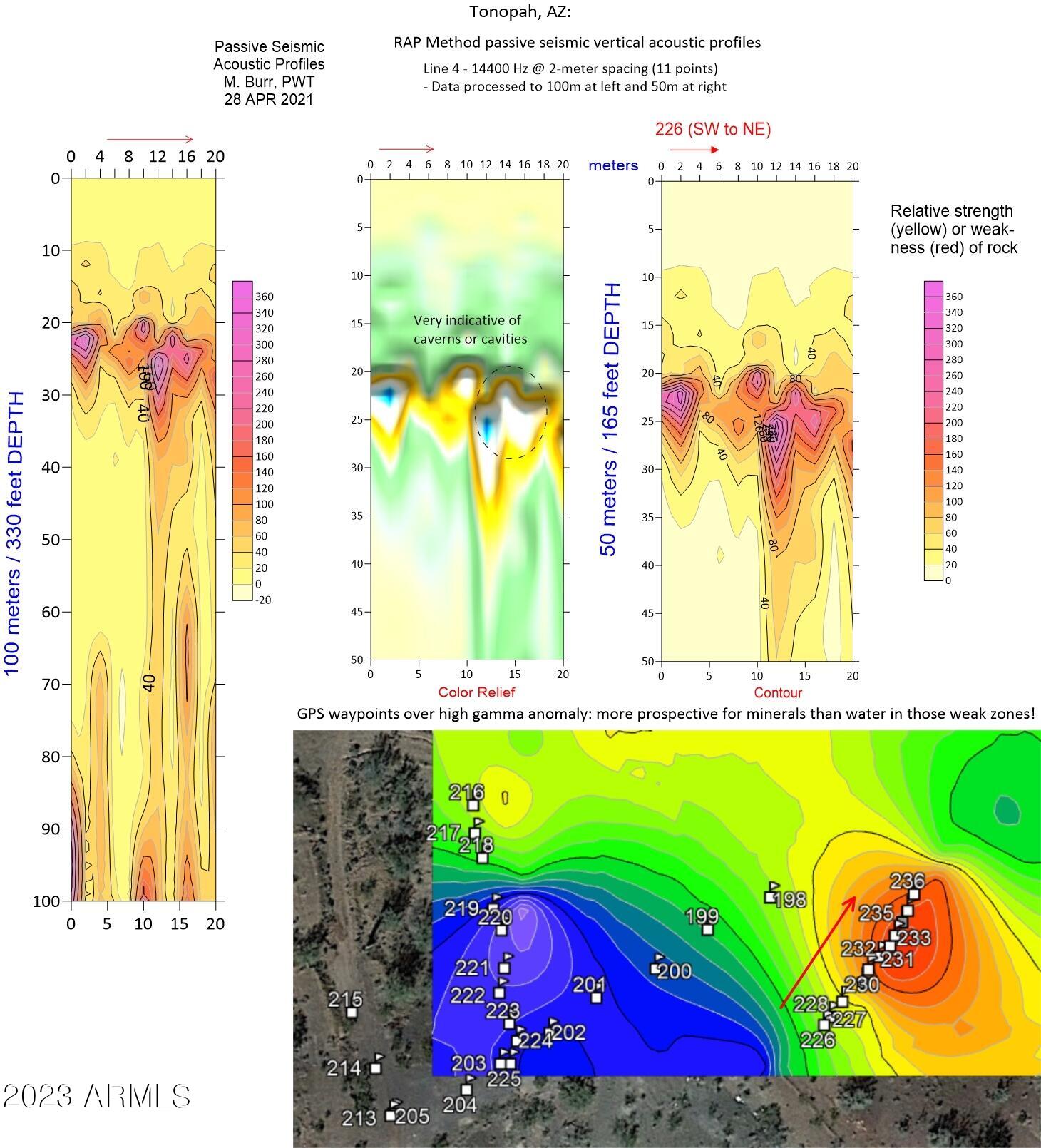
Geology
From neighboring property
The Property is located in the western Harquahala Mountains in the Basin and Range Province of southwestern United States. The Basin and Range Province is a Cenozoic-age terrane, 350 to 900 km wide, that extends from southern Canada to southern Mexico and occupies much of the western United States. The Province is characterized by widespread, voluminous, Cenozoic magmatism and highly variable east-west extension of 10 to 300%. Magmatism and extension appear to have been localized in numerous north-trending corridors, starting as early as 50 Ma in northeastern Nevada and leading to the formation of hundreds of individual basin and range pairs separated by normal faults with major offsets. The Harquahala Mountains is one of these ranges and is bordered on the north and south by broad alluvial basins. Basin and Range extension has also created detachment, normal, and oblique faults in the Property area.
Tertiary-age Basin and Range extension in the region was preceded by the Laramide and Sevier Orogenies. The Laramide Orogeny was a continental-scale compressional tectonic event resulting from generally northeast-directed subduction of the Farallon (Pacific) Plate beneath the North American Plate during the period 97 to 35 Ma, that resulted in widespread metamorphism, magmatism, folding, and thrust faulting throughout western North American. It was also a major metallogenic event, creating the large porphyry copper deposits of the western U.S., Mexico, and Canada, as well as the orogenic gold deposits in California, the Canadian Cordillera, and western Mexico.
The Property is located within the Mojave-Sonora Gold Belt, a trend that includes 17 mines and deposits with more than 34 million contained ounces of gold (Figure 7.1). Gold deposits in the belt are dominantly orogenic- type and many are related to shallow-dipping thrust faults that formed as a result of Laramide compression. The orogenic gold deposits formed from gold-bearing metamorphic fluids generated by compression and dewatering of subducted oceanic sediments migrating up major fluid pathways to depositional sites beneath or within thrust faults. Age dates in the region, combined with structure, mineralogy, alteration, anomalous trace elements, and geophysical results indicate that gold mineralization within the Property is likely orogenic and of Laramide age.
The Property is located in the eastern end of the east-trending Maria Fold and Thrust Belt that is 25 to 35 km wide and is characterized by south-vergent, large-scale folds, thrust faults, and metamorphism (Spencer and Reynolds, 1990; Richard, et al., 1990; Salem, 2009; Figure 7.2). The east trend of the Maria Fold and Thrust Belt is anomalous within the northwest-trending Mojave-Sonora Gold Belt as well as within the north-trending structures of the Cordilleran Orogen to the north. North-south compression in the Maria Fold and Thrust Belt, between 97 to 67 Ma (Salem, 2009), has been correlated with syntectonic deposition of the upper McCoy Mountains Formation of Cretaceous age (116 to 84 Ma; Barth et al., 2004), located within and to the south of the Maria Fold and Thrust Belt. The McCoy Mountains Formation is the prospective host rock for gold mineralization within the Property.
The Maria Fold and Thrust Belt in the Property area includes as many as eight stacked thrust plates and thrust faults that record several phases of Late Cretaceous, Laramide and Sevier-aged crustal shortening. The thrust faults interleave a wide range of rocks, including Proterozoic metamorphic rocks, Paleozoic sedimentary rocks, Jurassic volcanics and intrusives, Cretaceous intrusive and sedimentary rocks, and Tertiary volcanics and sediments. Figures 7.3 and 7.4 show the principal thrust faults and tectonic plates in the Property area, Figure 7.5 shows the regional geology, and Table 7.1 shows the stratigraphy of the Property region.
Magmatism in the region includes Late Cretaceous-age plutons ranging in age from about 79 to 54 Ma (Richard et al, 1990; Richard et al, 1998; Salem, 2009). Laramide compression and magmatism was followed by uplift, erosion, and Basin and Range extension beginning around 25 Ma, that resulted in northwest-trending high- angle normal and strike-slip oblique faults, and large-displacement detachment faults (Reynolds and Spencer, 1985; Richard et al, 1990).
History
From Neighboring property report
The earliest documented activity on the Property was the production of gold,during the late 1880s and early 1900s from numerous small prospecting pits, trenches, shafts and adits located on quartz veins. (Pincock, Allen & Holt, 2006). Although no records of it are available, a reverse-circulation drill program consisting of 25 holes to depths of 60 meters was reportedly conducted somewhere on the Rex property in the mid-1980’s; Pincock, Allen & Holt (2006) report that “all drillholes indicated gold mineralization.”
In 1987, Newmont Mining was reported to have collected 20 surface samples and reported assays in the range 5.5 to 52.1 g/t Au (0.16 to 1.52 opt; Pincock, Allen & Holt, 2006). In 1987 and 1988, Newmont drilled 663 meters in eight vertical diamond drillholes to depths of 61 to 107 m in an area underlain by Early Proterozoic- age heterogeneous gneiss. This drill program is described in Section 6.2.
In the late 1990s, Robert Chastain who owned the Property at that time, reportedly produced 280 ounces of gold by cyanide leaching. (Pincock, Allen & Holt, 2006).
In 2003, International Energy and Resources Inc. staked 102 unpatented lode claims (IER 1-102) to cover the Rex Property; these claims are now controlled by USAE. In 2003 Shield Environmental Associates Inc. conducted geologic studies and collected 79 surface samples of quartz veins and stockpiled mineralization that ranged up to 79 g/t Au (2.1 opt Au); (Shield Environmental, 2004).
In 2006, Pincock, Allen & Holt evaluated the Property for International Energy and Resources. (Pincock, Allen & Holt, 2006).
In 2010, consulting geologist Brian Alers evaluated the Rex property for Standard Gold Inc. and collected 12 grab and channel samples from three locations previously sampled by Shield Environmental. Six of these samples assayed from 1.1 to12.4 g/t Au (0.03 to 0.36 opt Au) and confirmed the gold values previously reported (Alers, 2010).
In 2010, Standard Gold entered into a joint venture option agreement with USAE. and contracted SRK Consulting (U.S.) Inc. to complete a review of the Property. SRK recommended that Standard Gold twin one or more of the eight Newmont Mining drillholes and sample selected locations to verify the Newmont drill hole assays and previously reported surface assays.
There was no work on the Property between 2010 and the USAE program that began in 2019.
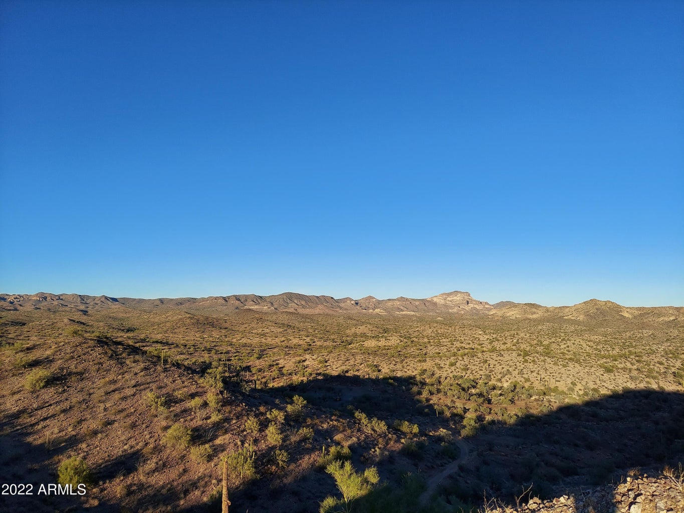
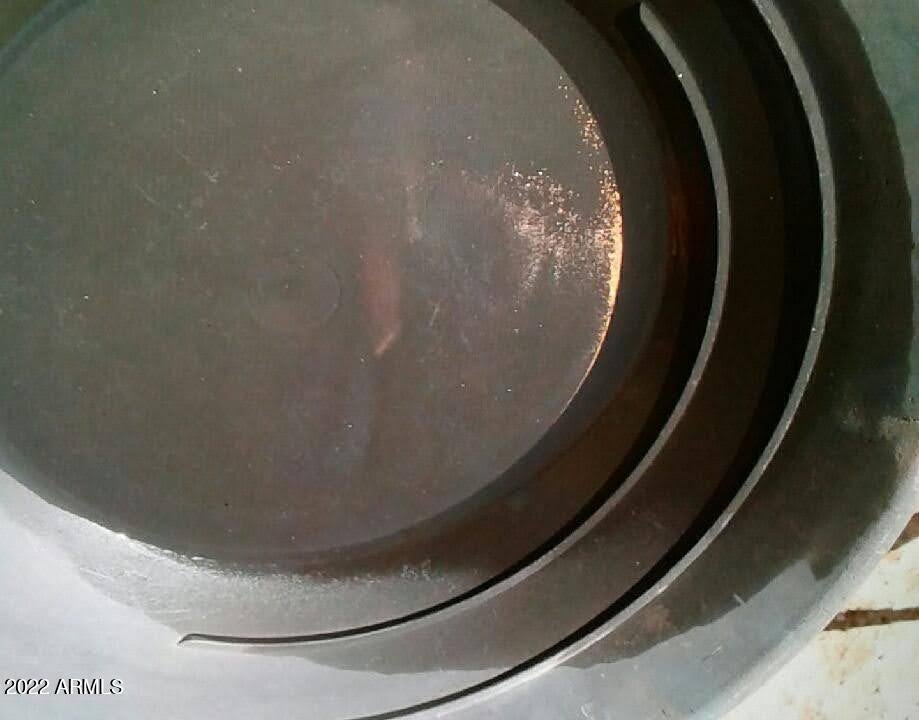
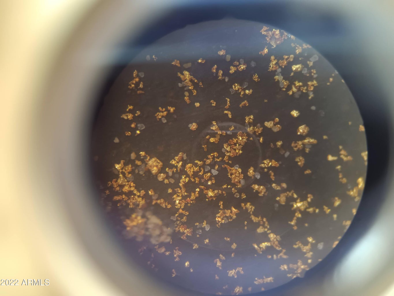
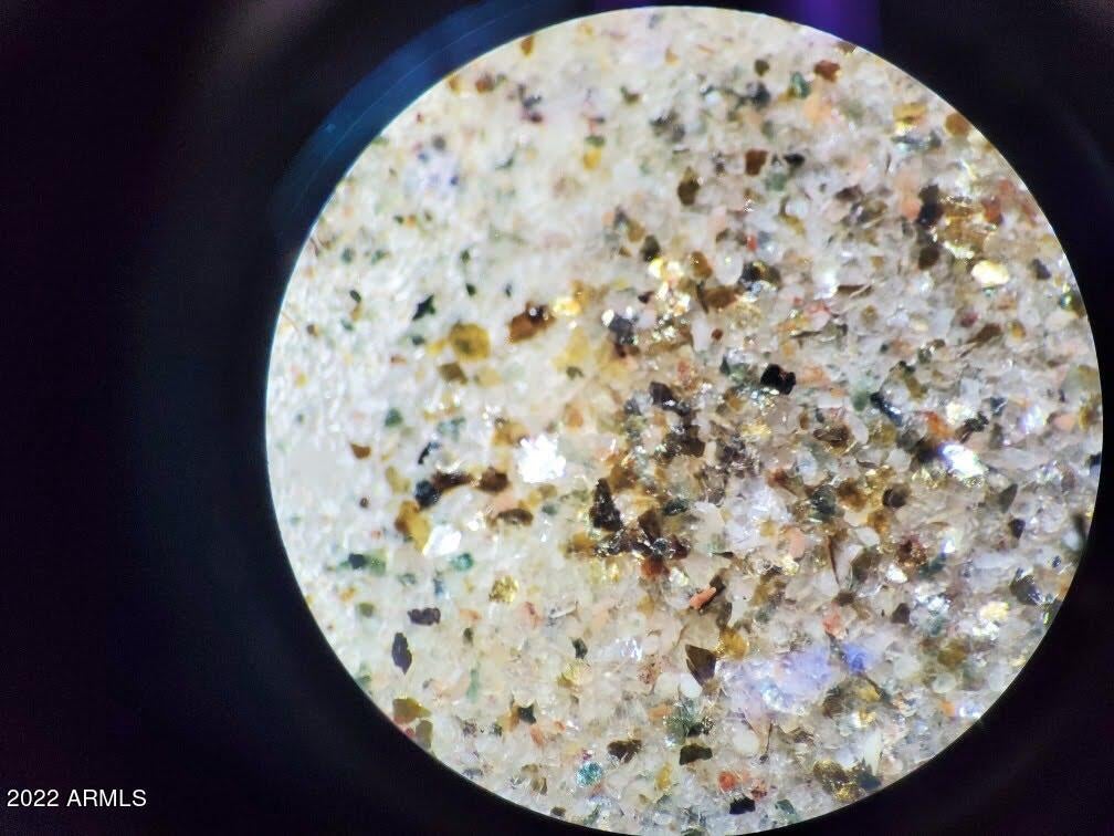
Photos
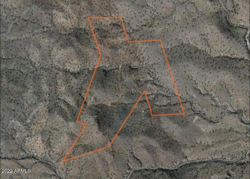
Map
Contact Seller
Please use the form below to contact the seller about this property:
Browse More Properties