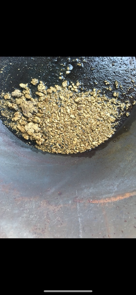
Frisco Creek Placer Mine
Gold & Silver Mine For Sale
Property Details
| Location | Canada, Yukon |
|---|---|
| Commodities | Gold, Silver |
| Deposit Type | Placer |
| Mining Phase | Development |
| Asking Price | 5,000,000CAD |
| Available Terms | Negotiable |
| Listing Tier | Premium |
| Market Status | Listed |
Summary
Location and Access
Frisco Creek is in the heart of the “Golden Saddle” in the Yukon Territory, north of the coffee creek gold and Casino mine projects. Frisco Creek is a tributary to the Yukon River. Access is by river and air only.
Description
Geology
The regional geology is well described in an Underworld Resources report (Pausen, 2009):
The Stewart River area is unglaciated. Basement geology consists of at least five stacked thrust sheets of lower to middle-amphibolite facies Yukon-Tanana schist and gneiss (MacKenzie, 2008).
Metasedimentary rocks are predominately siliciclastic, consisting of quartzite, quartz-mica schist and paragneiss, and meta-conglomerate; minor carbonate units also exist (Ryan and Gordey, 2001).. Mafic amphibolite is likely basaltic in origin. Some quartz-sericite schists or felsites exist, probably felsic volcanic or hypabyssal volcanic in origin. Orthogneisses are of unknown age, and range in composition from felsic to mafic, it has been suggested that the mafic orthgneisses may comprise a subvolcanic intrusive complex, and the potassic augen gneisses may correlate with a suite of Devonian to Mississippian granitic intrusions (Ryan and Gordey, 2001). There were several episodes of magmatism, and the Paleozoic package is intruded by Jurassic, Cretaceous, and Eocene plutonic rocks, and Cretaceous volcanic rocks (Ryan et al., 2003),Permian metamorphic fabrics have been overprinted during Jurassic thrusting, with subsequent deformation associated with late Cretaceous normal faulting. Mineralization occurred prior to, or during this period of regional extension, and may be related to post-metamorphic orogenesis, or deeper buried (Tombstone Suite?) plutonism History hard rock exploration is well summarized below in a report by Madalena
Ventures Inc. (Doherty, 2005):
Descriptions given for the individual Minfile occurrence do not highlight isolated mineral occurrence, but provide a history of changing quartz claim ownership within the general area of the individual Minfile occurrence. These ground positions have often overlapped and may have covered one or more of the specified Minfile positions, as is currently the case.
The mineral rights for portions of the current property have been owned by a variety of individuals as indicated by summaries of claim records. The earliest documented exploration activity on or within the property area coincides with the timing of the 'Klondike Gold Rush' with claims being staked by a number of individual interests between 1897 and 1907. Activity during this period occurred on the three riverside claims (115O 011 Shamrock, with staking in 1898 & 1900; 012 Northern Lights, staking in 1897, 1900, 1902 & 1907; and the 013 Donahue with staking in 1900, 1901). Records of work preformed during this early period are lacking. The Donahue (Minfile 115O 013)is the e only occurrence for which turn of the century exploration activity is reported.
Initially staked as Star City claims (4613) in September 1900 by N.J. Donahue and J.J. McKinnon, the property was explored with a 15-metre adit, 9 metre cross-cut and 4 metre shaft in the following year. Donahue & McKinnon reported the discovery of a sulphide-quartz zone up to 4.6 m wide bounded by porphyritic rock. They also claimed that the zone was mineralized with free gold plus silver and antimony values but that was never substantiated (Minfile 115O 013).
Resurgence in exploration activity occurred in the late 1960s and early 1970s with Canadian Occidental Petroleum Ltd. conducting reconnaissance exploration in the area with follow up grid soil sampling and geological mapping In the early to mid 1990s there was again renewed staking activity over the earlier riverside claims (115O 011 Shamrock, 012 Northern Lights and 013 Donahue) but there is no reported exploration activity. It was during this period in 1992-3 that staking in the Frisco Creek area was first documented (Minfile 115O 155). Exploration reported for the Frisco includes bulldozer trenching, stripping and roadwork. There is no indication of any significant discoveries.
In late 1998 a similar, but somewhat smaller ground position to the current one was staked by Teck Corporation (now Teck-Cominco Ltd.) when prospecting the area identified the Teacher Showing. This is an intrusion-related style of mineralization with quartz sulphide chert/breccia containing galena, stibnite and pyrite mineralization returned assays as high as 5.84 g/t Au. They also discovered quartz float with chalcopyrite and galena near the headwaters of Minneapolis Creek, which returned assays of 6.46 g/t Au and 26.5 g/t Ag. In 1999 Teck conducted limited prospecting and geological mapping of the main slopes and drainages and collected random rock and stream silt assay samples, In addition, a small 1.35 line kilometre soil grid was established over the Teacher Showing. Soil sampling identified a strong anomaly 50 m southeast of the showing with values up to 365 ppb Au, 630 ppm As and 155 ppm Sb. In2000, Teck focused most of their exploration efforts in and around the Teacher showing. They carried out hand-trenching, expanded soil sampling and further prospecting. Trenching over the soil anomaly identified in 1999 encountered silicified and brecciated metasedimentary float, which returned values rangingfrom nil to 12.15 g/t Au. The highest assay also returned 13.0 g/t Ag, 10 000 ppm As and 275 ppm
Sb. Expanded soil sampling in 2000 returned several new multi-element anomalies, on trend with the Teacher showing. A reconnaissance soil line collected over the location of the gold bearing quartz float in Minneapolis Creek returned values up to 75 ppb Au, 1 445 ppm As, 20 ppmSb, 135 ppm Cu and 391 ppm Zn.
The latest hard rock exploration work performed is taken from Yukon Minfile
Occurrence 115O 074 Donahue:
The area surrounding this location is underlain by Devonian to Mississippian age
psammite/quartz-mica schist. This portion of the White claims was not explored until 2007 at which time Underworld Resources carried out geological mapping and soil and rock sampling.
The results were added to previous year’s results. Soil sampling to date across the White claim block outlined a large gold, arsenic and antimony soil anomaly measuring 8 by 3.5 km across the length of the claim block. The anomaly consists of numerous discrete gold anomalies with a threshold of 50 ppb gold.
Soil sampling in 2007 outlined the Donahue gold zone (soil anomaly – this occurrence). The Donahue gold zone measures 800 by 700 m with 35 of 374 samples exceeding 40 ppb gold. The average of the anomalous samples was 414 ppb gold with a maximum value of 9 019 ppb gold (Underworld press release 12 Feb/2008). Further soil sampling in 2008 outlined the South Donahue gold zone located 1.5 km to the south. The single 2008 diamond drill hole was collared towards the northwest end of the Donahue gold soil anomaly. Hole WD-015 returned 1.30 g/t gold over 1.0 m from a down hole depth of between 114.50 and 115.50 m.
Trenching, soil and rock sampling carried out in 2009 at the Donahue soil anomaly encountered, near surface gold mineralization similar in style to the Golden Saddle deposit (Minfile Occurrence # 115O 165). Diamond drill hole DN09-01collared on the Donahue soil anomaly returned 1.00 g/t
gold over 2 m while hole DN09-03 returned 21.5 g/t over 0.73 m. Hole DN09-02 did not return any significant intersections (Underworld Press Release – Sep 10/2009).
The South Donahue gold zone occurs in similar host rocks to the Golden Saddle deposit and possesses similar geochemical signature. Diamond drilling intersected 1 to 5 m thick quartz veins hosted within an altered granitoid, however no significant values were returned from any of the five drill holes (Underworld Press Release – Oct 19/2009).
Since its take-over of Underworld Resources, Kinross Gold has not publicly released any detailedresults from the White Gold project.
Essentially, a valid hard rock source(s) of native gold exists within the watershed of Frisco Creek, the area is unglaciated and course gold has been recovered at good grades
and shallow depths strongly indicating that there is great potential for an economically
viable placer gold operation in this watershed.
Additional Information
Contact for info
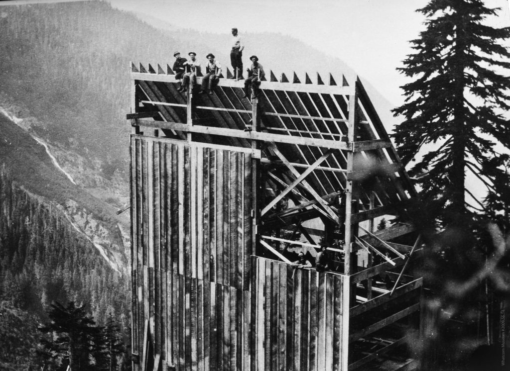
Photos
Contact Seller
Please use the form below to contact the seller about this property:
Browse More Properties