
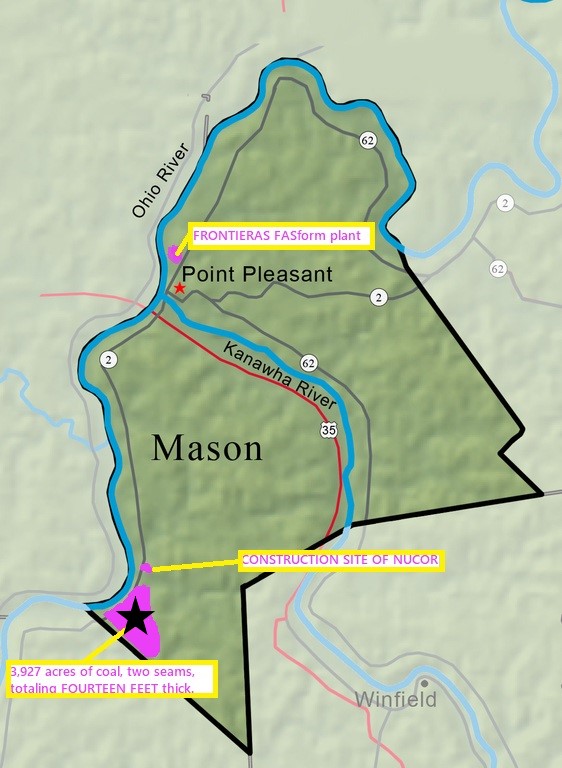
3927 Acres COAL, 2 seams totaling 14′ thick.
Mason County, West Virginia COAL LAND 3,927 acres
Property Details
| Location | USA, West Virginia |
|---|---|
| Address | Glenwood, WV, USA 25520 |
| Commodities | Coal |
| Deposit Type | Hard rock |
| Mining Phase | Exploration |
| Asking Price | Lease or Sale |
| Available Terms | For Lease, For Sale |
| Listing Tier | Standard |
| Market Status | Listed |
Summary
Location and Access
Fourteen feet of coal Located 12 miles south of the planned Mountaineer Gigasystem AI Monarch Compute Campus, Fidelis New Energy, and Babcock & Wilcox BrightLoop facilities in North Point Pleasant, West Virginia. Perfect for its own AI edge compute hydrogen microgrid. Co2 pipelines are planned near this property in the next 1-3 years. Situated along the Ohio River in Mason County, West Virginia, near the town of Glenwood, this rural and sparsely populated property is accessible by state and county roads. It is bordered by a CSX Class 1 freight rail line and lies within Qualified Opportunity Zone No. 54053955102, with ZIP code 25520. Situate cascades of Armada Galleon Leviathan or equivalent mobile data centers on this property
Description
Geology
Relevant coal seams are believed to be above drainage
History
In 1904, while drilling for oil half a mile from Glenwood, West Virginia, a driller struck coal over a continuous 12-foot seam, sparking interest in the property. (Coal and Trade Journal, Vol. 35, Vol. 43, p. 891, 1904).
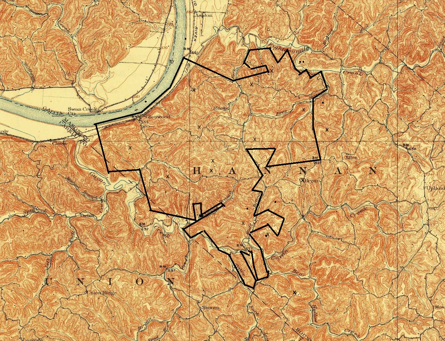
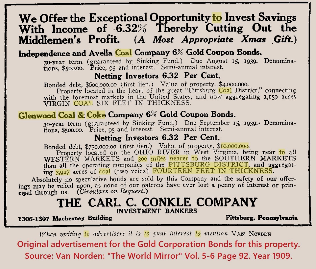
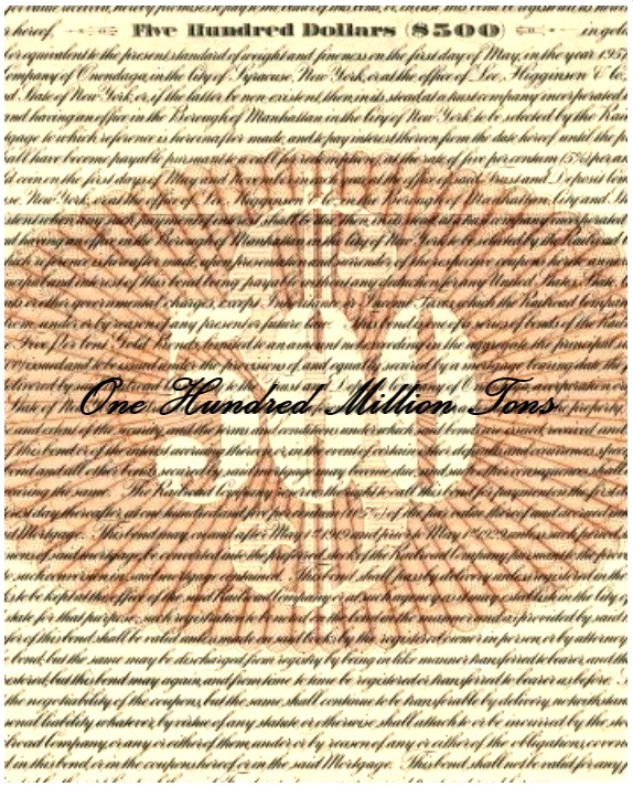
In 1907, Pennsylvania and West Virginia investors formed the Glenwood Coal and Coke Company in Mason County, West Virginia, with a capital stock of $100,000. Led by seasoned mining capitalists, the company—occasionally misnamed the "Glenwood Coal & Oil Company" in trade publications—focused its operations near Glenwood. It acquired a contiguous 3,927-acre block of coal rights, targeting two seams with a combined thickness of 14 feet. Over several years, significant capital was invested in prospecting, mapping, securing coal rights, and issuing gold coupon bonds. The company dissolved in 1932, and the property was sold to the State of West Virginia at the peak of the Great Depression, with scientific reports, diamond core samples, and other records presumed lost.
Renowned West Virginia State Geologist Dr. Israel C. White documented commercially significant Monongahela Series coal deposits at Glenwood in 1904, 1906, 1908, and 1921. His findings, including the "Map of West Virginia Showing Coal, Oil, Gas, and Limestone Areas," were published by the West Virginia Geological Survey (Source: https://dp.la/primary-source-sets/when-miners-strike-west-virginia-coal-mining-and-labor-history/sources/973).
The property was later acquired from coal company heirs who held it for decades, inheriting it from their father, a prominent operator of coal mines across two states. He purchased the Glenwood coal lands from the State of West Virginia in 1949 but, preoccupied with other mining ventures, conducted no development beyond confirming its location. past owners, unaware of the historical records or gold bonds, made no efforts to promote develop. It is truly a lost treasure.
Additional Information
Undivided 100% coal only interest. Pittsburg coal seams at least 100' above drainage in Southern Mason County, West Virginia
Glenwood Coal & Coke Company, LLC of West Virginia
Photos
Map
Contact Seller
Please use the form below to contact the seller about this property: