Golden Porcupine SE – Novack Occurrence Gold Property
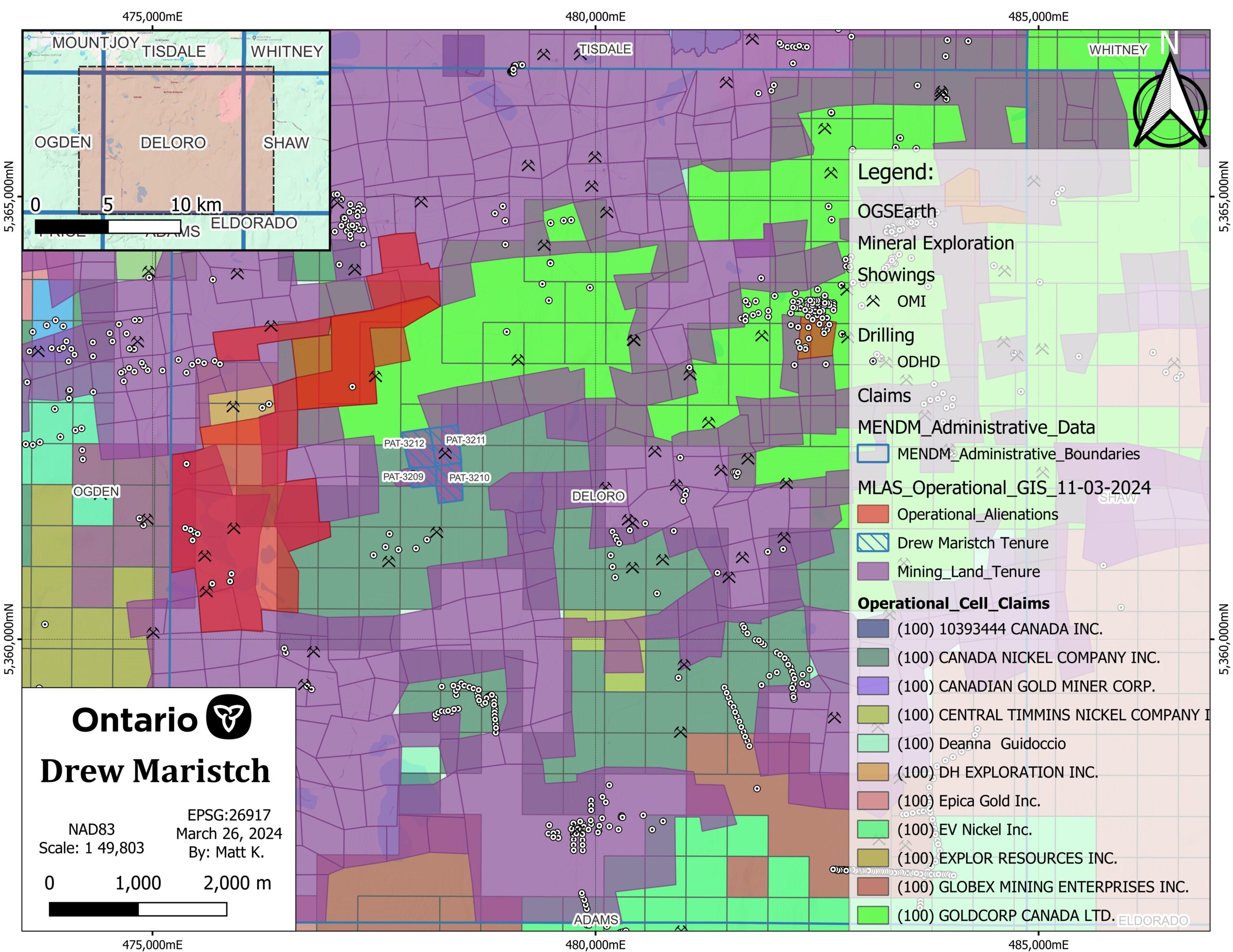
Patented Gold Claims on PDFZ Structural Splays–Timmins, ON
Summary
Location and Access
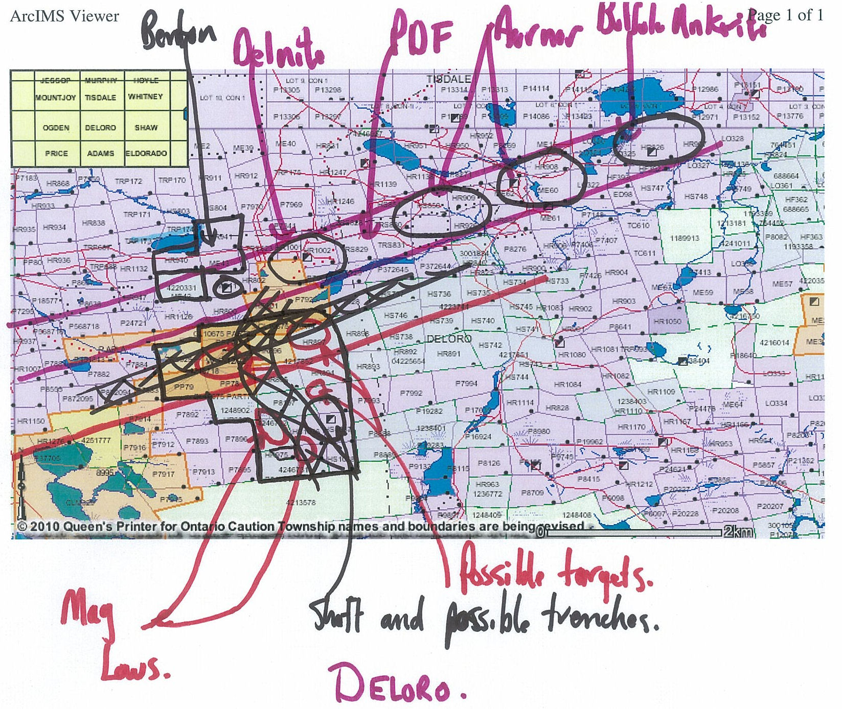
Golden Porcupine Southeast (Novack Occurrence) resides in the southwest portion
of Deloro Township generally between McKay Lake to the southeast and Flynn Lake to
the southwest. The north boundary of the block lies about 800 meters south of the Delnite
Town site and Minesite. Deloro Township is situated in the Porcupine Mining Division in
Northeastern Ontario. More specifically the property is located approximately 7 kilometers southeast of
the City of Timmins.
Pine Street runs south from the City of Timmins and merges with an all-weather
gravel road that runs south and east of the property. There are several good ingress
gravel roads that run west off this all-weather road that provided good access to most of
the western and northern sections of the grid area. Travel time from the City of Timmins
to the property (conditions permitting) is approximately 25 minutes.
Description
Geology
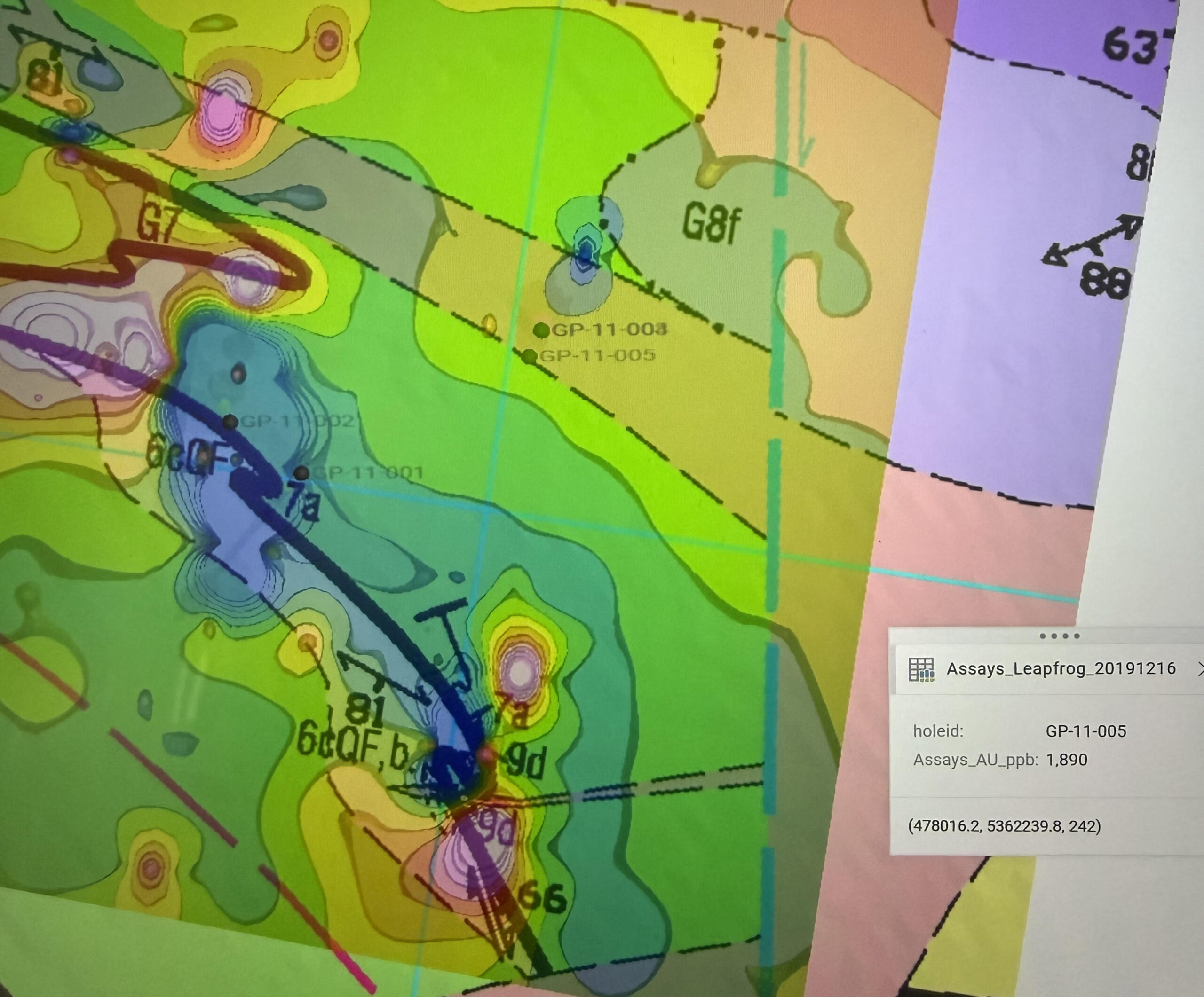
The property lies within the Archean Abitibi Greenstone Belt and is interpreted to occur along secondary splays of the Porcupine–Destor Fault Zone, a major structural corridor controlling gold mineralization in the Timmins camp.
Gold mineralization appears associated with shear-hosted structures, with drilling and geochemical anomalies defining a structurally controlled mineralized corridor.
History
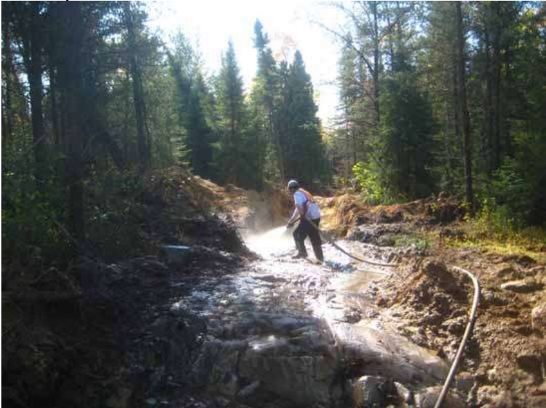
Exploration work on the property includes geochemical surveys and diamond drilling programs completed in the late 2000s and early 2010s.
Drilling confirmed the presence of gold mineralization including intercepts of 1.89 g/t Au, supporting the interpretation of a mineralized shear zone within the property.
Further exploration potential remains along strike of the identified structures.
Additional Information
• 4 patented claims (PAT 3209–3212)
• Approx. 111 acres
• Located within the Timmins gold camp
• Structural association with Porcupine–Destor Fault Zone splays
• Drill confirmed gold mineralization
• Additional geochemical and structural targets remain untested
A complete data package including drill logs, geochemistry and maps is available upon request.
Photos
Map
Contact Seller
Please use the form below to contact the seller about this property: