Location and Access
Located up an Easy high clearance 2WD road just outside of Twin Bridges, Montana
Description
The East camp consists of a large working adit with a sizable waste dump which shows quartz, iron and some bits of flake gold. The adit is largely collapsed and not safe to access in its current condition. It has remnants of a door and a covered entrance, both of which have given into the elements and years. From the portal, it is possible to see the drift for roughly 40’ before it turns beyond line of sight.
Working up the hill from the assumed haulage adit there are a series of shafts and cuts culminating at the largest shaft near the top of the hill. This shaft is collapsed and is likely an incline that would need to be dug out to assess. Drift workings can be seen from the other shafts leading to the assumption that the adit and shafts are interconnected. There is a well-defined quartz vein at the adit and visible in the open shafts. This is noted in historic geological reports as bearing native gold deposits. It is also simple to map the lode on the surface by the workings and outcrops.
There is also a spring at the east camp that flows 2-5 GPM and pools on the property. There is some tree cover and an excellent flat for parking and or staging equipment for some onsite processing and testing.
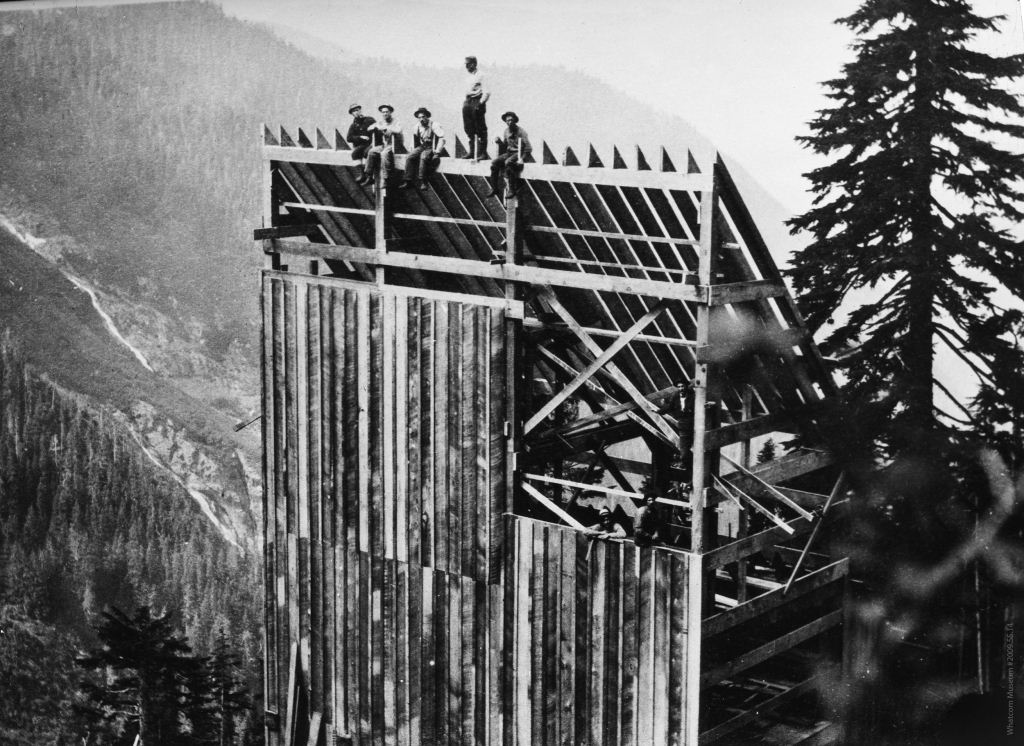
The West Camp is located one canyon to the west of the East Camp, hence the naming. The west camp is reached by following a road up the gulch to the mine. The remnants of a large shaft and headframe can be seen from some distance. The shaft appears to be intact but has been filled with trash and debris from around the site such as wood, timbers and metal plates. There also is what appears to be an adit just above the shaft. This adit is also filled with timber and debris and should be cleared prior to access.
There is no noted vein that can be seen at the shaft, but a series of small shafts and prospects working up the gulch show a milky quartz body that continues in a northerly direction. The small shafts and prospects are largely open and untouched but not accessible without rope or ladder.
The waste dump at the west camp shows crushed quartz and some flake gold. The dump is estimated at 35k tons based on measurements.
According to geological mapping and documentation, the gold bearing veins noted above have been recorded and are documented as valuable. There is also a cross vein that is estimated to run in an east west direction between the two mines. This vein has not been officially mapped, nor has any connection between the two mines been defined. While it makes sense that the Western camp could follow a vein towards the eastern camp and there is evidence of same, it is an unproven theory at this time.
The waste dumps on the mine properties both show quartz and flake bits of gold, this is usually an indication that there was gold being extracted from the quartz and as the vein was broken out of the quartz, the remaining quartz with small remnants of gold was discarded.
The property is in close proximity to Twin Bridges and Dillon, Montana, both of which offer a variety of services and supplies.
Geology
Contact Vendor for a GRMP-43 report that details the geology of the Walker Mineral Property.
History
Contact Vendor for a GRMP-43 report that details the history of the Walker Mineral Property
Additional Information
The Walker Mining property is a 20-acre lode mining claim positioned to cover the general trends of established, native gold bearing veins and the overall workings of the historic Walker Gold Mine. Contact Jason for more information or with questions.