Pineau Placer Mine
Montana Coarse Gold Placer Mine
Summary
Location and Access
The historic Pineau Placer is located near the headwaters of Gold Creek in Granite County, Montana. It is accessible from Interstate 90 off exit at Gold Creek, Montana. Access road is mostly gravel and is accessible by car. Heavy equipment accessible. The mine property its situated at 7000 feet elevation and generally is snowed in from December-March.
Description
Geology
Much of the placer gold is deposited along granitic bedrock and is contained in glacial
till deposited during different stages of glacial advance. The majority of the coarse gold
is found within till of the earliest stage which rests directly on bedrock and is usually 1-
3 feet thick. The early till is comprised mostly of tan and gray quartzite clasts and
usually exhibits a rusty color owing to high iron content. Some gold is found in an intermediate aged till which is
comprised of a greater proportion of metasedimentary and metamorphic rocks such as
schist and hornfels. Younger till covers much of the area as varying thicknesses (2-12 feet average) of barren overburden and
is comprised almost entirely of white granodiorite boulders and clasts.
Erosional channels, possibly ancestral stream channels, and/or joints in the underlying
bedrock that trend obliquely to the present stream course act as natural traps for the
placer gold.
In 1983-1985, the Jacobsen mining operation encountered bedrock depressions and erosional channels and, when found, they yielded over 40 ounces of coarse gold per day with a 100 yard/day operation. A geological study of the area was conducted for Montana Mining and Timber in 1985 prior to their acquisition of the unpatented claims. The report presents the results of test pit sampling and summarizes ore grade and quantity (available for inspection). Placer gold values vary widely with historic grades up to 0.65 ounces per cubic yard. Nuggets are common.
History
The Pineau Placer (aka McFarland placer) was the largest producer on the stream itself. Although some mining was reported in 1870, serious development did not begin until 1896. From 1896 to 1913 the placer produced $35,000 (at $20/ounce). The claim was primarily worked by sluices with boulders blasted or lifted out of the stream by a derrick. Gold recovered was about 790 fine with nuggets up to 10 ounces. Placer gold appears to have originated principally from the veins in the mountainous area upstream with a significant deposit of residual placer formed from gold-bearing veins in the floor of the placer.
The Pineau placer is one of the largest producers in the district as well as being the best documented. The placer was located on the upper middle fork of Gold Creek around 1870, but development of the placer did not occur until 1896. Gus Pineau, Eugeen McFarland and Green Dudley discovered the Friday placer mine in 1895. Shortly thereafter McFarland and Pineau, along with two new partners, began mining the other nearby claims. McFarland is credited with the camp associated with the Pineau Placer. This camp is shown on USGS maps in 1905, 1908 and
1912 as the Anderson Cabins (Pineau Placer Camp).
The gold was coarse, with a minimum average size about that of a grain of wheat. It has yielded large nuggets, typically less than 10 ounces, but the largest weighed in at 27 ounces (on display at the Larabee Bank, Deer Lodge for many years). Much of the coarser gold was obtained while drift mining along bedrock.
J. H. Crockett worked the Pineau Placer in 1934. In 1934 the hydraulic operation was supported by a 450,000 gallon storage dam and 1.5 miles of ditch which delivered water with 150 feet of head to a #3 Giant nozzle. A 10-ton portable derrick was used to remove boulders and the gravel was washed in 500 feet of 20 x 20 inch sluice boxes.
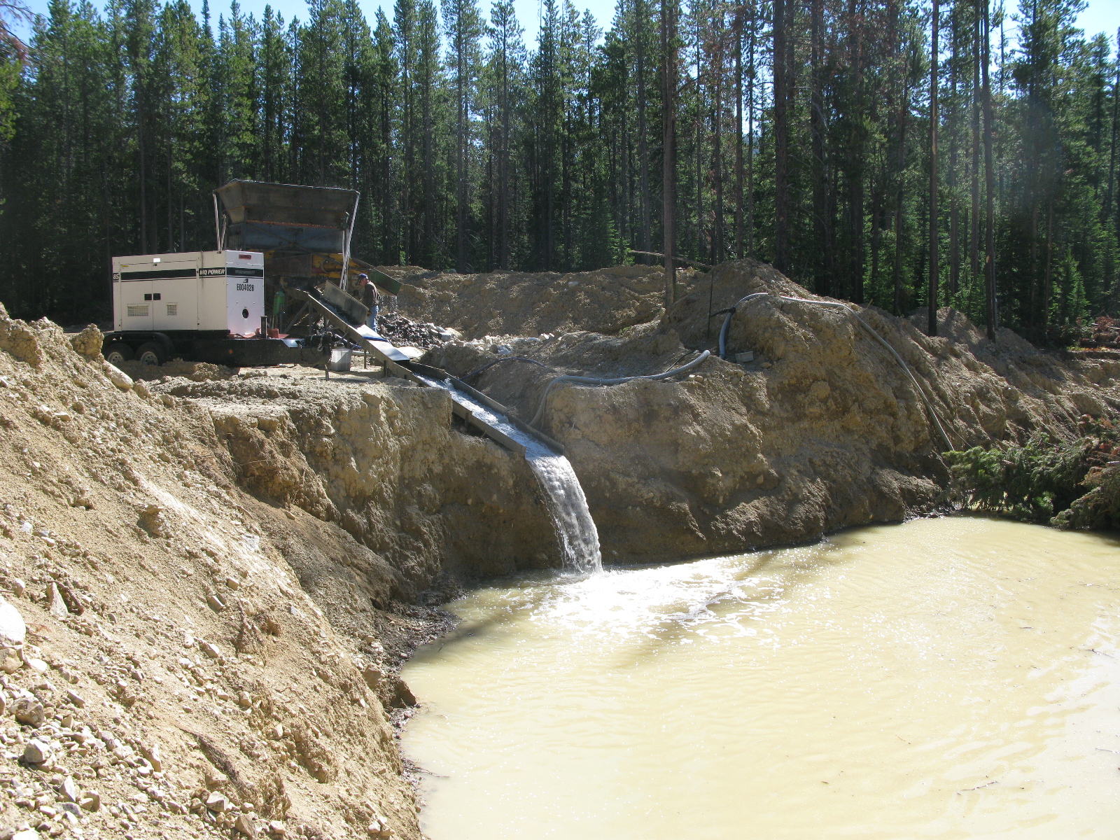
The mine was worked as recently as 1983 by Clifford Jacobsen of Deer Lodge, Montana. In 1983-85, Jacobsen operated a small wash plant fed with a backhoe and the operation recovered a significant amount of coarse gold with nuggets weighing up to 14 ounces. Jacobsen abandoned the mining operation after suffering health problems and the claims were sold to Montana Mining and Timber Co. (MM&T) in 1986. MM&T continued
operations on the patented Master Mine but did not actively mine their unpatented holdings. The claims were ultimately acquired by the current owner in the mid 1990s.
Additional Information
Much additional information available with NDA. Contact Rob at 406-582-8491
Photos
Map
Contact Seller
Please use the form below to contact the seller about this property: